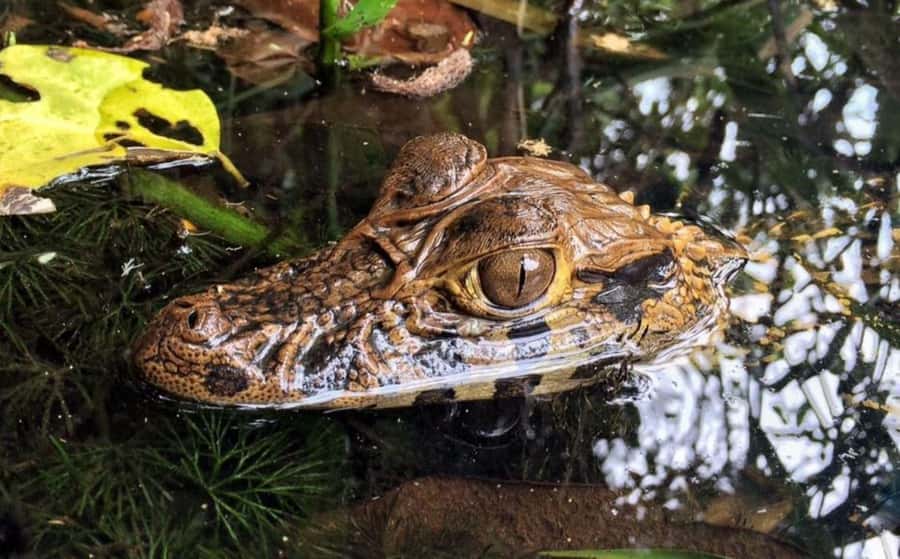
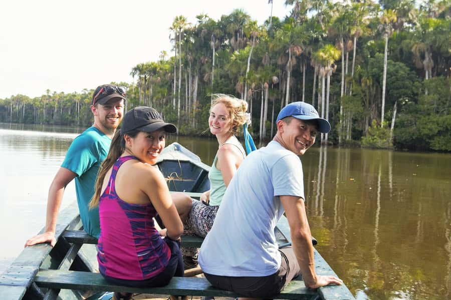
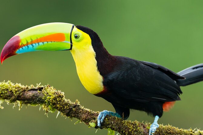
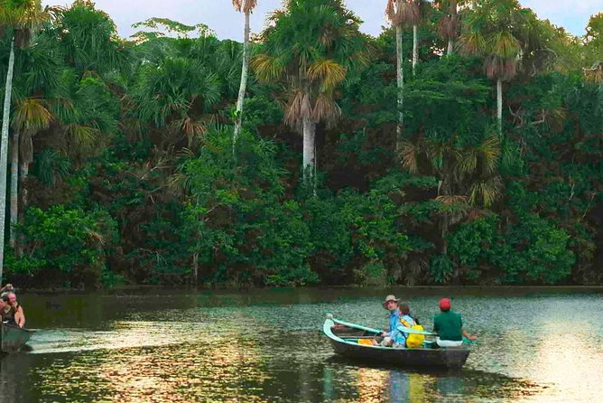
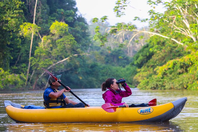
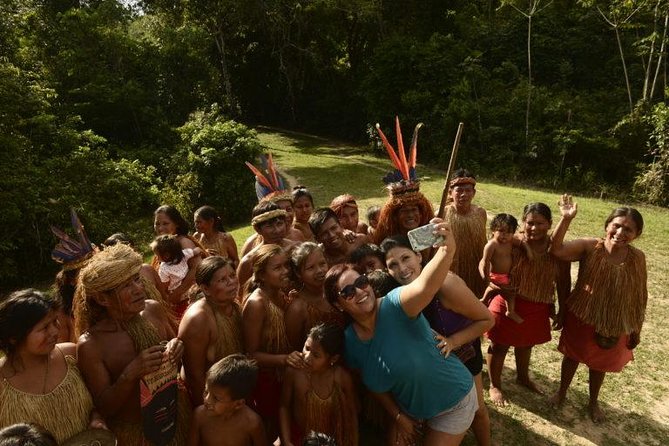
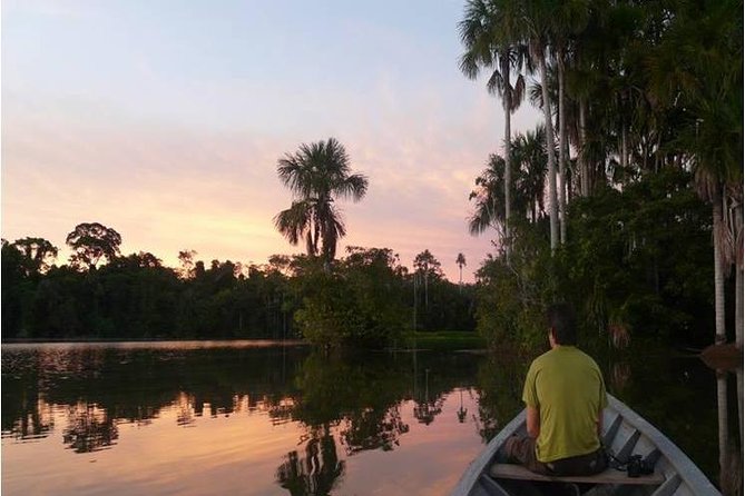
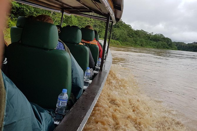
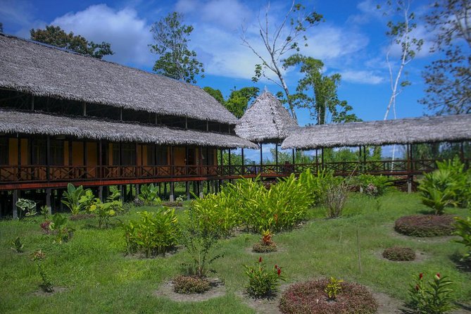
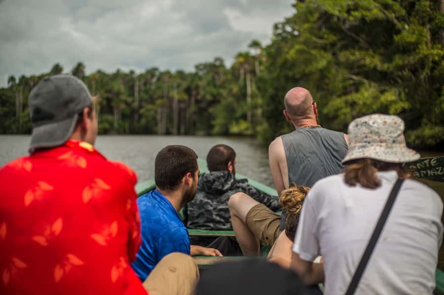
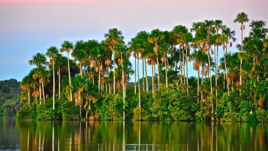
separador

www.welcomeperutravel.com

Agencia de Viajes Welcome Peru Travel
Welcome Peru Travel - Travel Agency - Tour Operator

separadorEnglish | Español

| History of Peru | Peru Tours | Tourism in Peru | Hotels |
| Useful information | Biodiversity |

Welcome Peru Travel - Mapsite | info@welcomeperutravel.com| www.welcomeperutravel.com | Imagenes, Turismo Peru, Aventuraseparador


> Welcome Peru

separador

> About us

separador

> Useful Information

separador

> Map of Peru

separador

> Sitemap

separador

> Tourism in Peru

separador

Lima
Historic Center
Caral
Cusco
Machu Picchu
Inca Trail
Salcantay
Choquequirao
Puno
Titicaca Lake
Arequipa
Colca Canyon
Nazca
Nazca Lines
Paracas Reserve
Ballestas Islands
Chan Chan
Sipan Lord
Puerto Maldonado
Manu
Tambopata
Candamo
Iquitos
Pacaya Samiria
Tarapoto
Huaraz

separador

PERU TOURS
Packages Tourist

separador

HOTELS
IN PERU

separador

> Transport

Air Transport
Land Transport
- Trains
- Buses

separador
Galeria Fotos Peru, Imagenes Peru

Photo Gallery

separador
Calendario Turistico Peru, Fiestas, Costumbres, Regiones Peru

Tourist Calendar

separador

Clima del Peru, Regiones Peru, Costa Peru, Sierra Peru, Selva Peru
separador
Noticias Peru, Turismo, Actualidad Turistica
separador

Terms and
Conditions

separador

Testimonial


To: Gisella Rojas From: Nora….
Date: Friday, November 26th, 2004
at 07.28 a.m.
Re. Nora Perdomo Dear Guisella Just a few lines to thank you for the excellent service you provide us. Your representatives in Cuzco were just great. We are going to give our best recommendations about you. It is a shame we couldn’t spend more time in Cuzco, but it may be an excuse to go back again. Thanks for everything


Read +


separador
separador


NATIONAL SANCTUARIES

They are designated to protect a species or an animal or plant community by declaring it intangible, and to preserve natural formations that are of scientific or scenic interest. At present, six national sanctuaries pr


otect 0.04% of Peru's land.

Huayllay
It consists of rock formations of various shapes and sizes produced by wind and water erosion and glacier movements. These formations resemble human and animal profiles and form doorways and arches. The forest shelters hot springs, which are believed to have medicinal properties, with temperatures reaching 60º C (140ºF). The place is also the habitat to deer, vicuñas, vizcachas, bobcats, skunks, hawks, and partridges. The flora is mainly composed of pastureland, queñual trees, huamanpinta bushes, putagas, and mata mata trees, or pargashes.

Location: Departaments of Junín and Pasco.
Area: 6 815 hectares
Altitudinal Rank: 4100-4546 masl.
Temperature: -3,7°C to 13.8°C
Rainy Season: December to March
Season: Arpil to November
Type of Entrance: the enter by the route 1, 2 and 3 is by center way. Canchacucho Town - Huayllay
Access: 45 km / 28 miles south of Cerro de Pasco (45 minutes by car).
Administrative Office: Jr. Simón Bolívar cuadra 8 oeste S/N Junín. Telefax: 34-4146

Subir


Calipuy

This bio-geographical area located between 840 and 3600 masl / 2756 and 11811 fasl, spreads over 4500 hectares. It shelters and protects one of biggest existing forests of the bromeliad, Puyas de Raimondi, along with Andean animal species like the Guanaco. Its climate is characterized by abundant rains betweenDecember and April. It is located in a wet highland moor, in the Suni Region.

Location:District of Chao and Santiago de Chuco, Provincia Virú and Santiago de Chuco, Departament: La Libertad.
Area: 64 000 hectares Altitudinal
Rank: 400-4000 masl.
Temperature: In the high part, of 18 -5º Cs to ºC. In the low part, of 12 ºC to 28º C.
Rainy Season: November to March
Season: April - October
Type of Entrance: Semi Restringed Entrance
Tariff: Services: Shelters and Police Position
Access: 164 km / 102 miles east of Trujillo until the city of Santiago de Chuco (8 hours by car) Activities: fauna Observation, flora Observation, Landscapes Observation, birds Observation, Long walking, studies for investigation, Photografies y films
Administrative office: Calle Alfonso Ugarte Nº 890. Sede de la Agencia Agraria , Santiago de Chuco.

Subir


Mejia Lakes

It possesses an area of 691 hectares and includes different habitats comprising swamps, salt marshes, tortora reeds, hills, riverside estuaries, fields of salt grass, and sandy beaches. It is ideal for bird-watching, and 195 specieshave been registered: 75 are resident species (you can find them there all year long), 6 are ocean residing species, and 80 are migratory ones that travel from places so diverse and distant as the Peruvian jungle and the Antarctic.

Location: Province of Islay, Departament of Arequipa
Area: 690.60 hectares
Altitudinal Rank: 0-50 masl.
Temperature: 19.8°C (Annual Average)
Rainy Season: Juner to September
Season: October - May
Type of Entrance:
With a Ticket Entrance Tariff:
Adult: 1 day: S/. 5.00; 3 days: S/. 10.00
Child: 1 day: S/. 1.50; 3 days: S/. 4.00
Access: 146 km / 91 miles southwest of Arequipa (2 hours and 10 minutes by car); 11 km / 7 miles south from the Mejia baths and 5 km / 3 miles south of Mollendo
Activities: Fauna Observation, Lanslade observation, long walking, studies for investigation, photografy and filmations
Administrative Office: Km. 32 Carretera Mollendo - Valle Tambo, Arequipa. Telephone: : (054) 80-0004

Subir


Santuario Nacional de Ampay

Located in the department of Apurimac, covering an area of 3,635 hectares, the national sanctuary protects the largest forests of intimpa trees in the Peruvian highlands. The intimpa is Peru's only native only conifer species, and the dense forests shelter many species of wildlife, largely birds. The sanctuary also features a series of glacial lakes and crystal-clear streams flowing down from the majestic snow-capped peak of Mount Ampay, which dominates the region and lends its name to this protected area.

Location: District of Tamburco, Province of Abancay, Departament of Apurímac
Area: 3 635,5 hectares
Altitudinal Rank: 2850 to 5200 masl.
Temperature: 14ºC a 0ºC
Rainy Season: October to March
Type of Entrance: Previous authorization and registry in the seat of the area.
Access: 5 km / 3 miles north of Abancay (10 minutes by car) is the ecological station where the 1.5-km hike (1 mile) to Lake Angascocha begins
Administrative Office: Km 7.5 La Granja San Antonio Tamburco- Abancay . . Telephone: : 051-9821696


Subir


Manglares de Tumbes

Located on the far northwest Peruvian coast, covering an area of 2,972 hectares, the Tumbes mangroves are the borderline for many species of flora and fauna associated with this kind of eco-system. The natural sanctuary protects the country's largest mangroves, and is a haven for the many varied animal species that feed off them. Particularly striking are the invertebrates, featuring an enormous variety of mollusks, including black scallops, 34 species of crustaceans, 33 types of snails and more than a hundred fish species. The sanctuary is also a key breeding ground for commercial marine species such as shrimp. Migratory and resident bird species, as well as the endangered black American alligator, a unique species, and the anteater, are just a few of the more interesting inhabitants of the area.

Location: District of Zarumilla, Province of Zarumilla, Departament of Tumbes
Area: 2 972 hectares
Altitudinal Rank: 0 masl.
Temperature: 22°C to 27°C
Rainy Season: January to March
Season: April to December
Type of Entrance: Free
Services: Rent of canoas, interpretations centers, radio.
Access: Located 30 km / 19 miles from the city of Tumbes (50 minutes by car). By air: daily flights from Lima to Tumbes (1:30 hours) By road: along the North Pan-American Highway, 1270 km / 789 miles north of Lima, 483 km / 300 miles north of Chiclayo and 282 km / 175 miles north
Activities: Guided Visits, Fauna observation, flora observation, birds observation, rent boats, long walking and studies to investigations.
Administrative Office: Av. Tarapacá Nº 427. Tumbes Telefax: (072) 52-6489


Subir


Tabaconas Namballe
This protected area of 29.500 hectares contains a mist forest with all its native flora and fauna, thirty-three bird species, and seventeen mammal species (among the highlighted ones are the spectacled bear, the mountain tapir, monkeys, little spotted cats, and deer).

Location: Districts of Tabaconas and Namballe , Province of San Ignacio, Departament of Cajamarca
Area: 29 500 hectares
Altitudinal Rank: 1500 a 3200 masl.
Temperature: 6°C to 12°C and 22.5°C to 24° C.
Rainy Season: January to March
Season: May to December
Type of Entrance: Free Access: 110 km / 68 miles north of the locality of Jaen (7 hours by car).
Activities: Fauna observation, flora observation, birds observation, long walking, studies to investigations, Camping, mystic rituals and photografies.
Administrative Office: Jr. San Martín N° 332, San Ignacio. Telefax: (076) 84-6166

Subir


separador


Peru Tours | Tourism in Peru
Contact us | Term and Conditions


Lima | Historic Center | Caral | Cusco | Machu Picchu | Inca Trail | Salcantay | Choquequirao | Puno
Titicaca Lake
| Arequipa | Colca Canyon | Nazca Lines | Nazca | Paracas Reserve | Ballestas Islands
Sipan Lord | Puerto Maldonado | Manu | Tambopata| Candamo | Iquitos | Pacaya Samiria | Tarapoto | Huaraz

Recurses 1 - 2 - 3 - 4 - 5

Welcome Peru Travel - Lima  | Reserved Rights
Calle Sta. Felicidad 270 - 2do piso Urb. Pando 3ra etapa . Cercado de Lima - Peru
info@welcomeperutravel.com | www.welcomeperutravel.com | Telefonos (51-1) 564-5710